


10:02 am

Club Member
March 6, 2012
 Offline


Picture from a Georgetown Local...
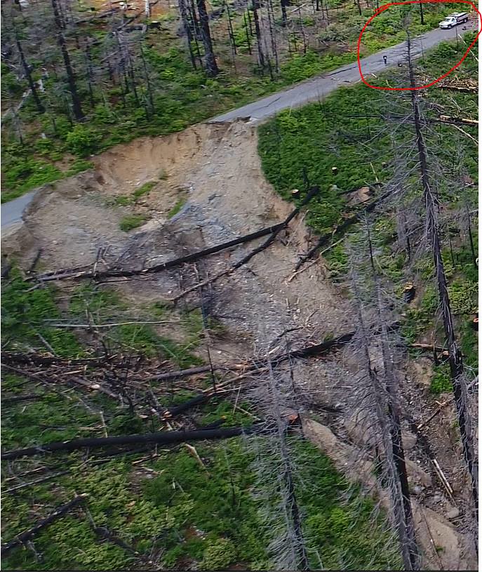

To estimate the size, find him standing in front of the truck flying the drone.
11:10 am

Club Member
July 14, 2016
 Online
 I spoke to Danny at WFO Concepts and they did Hell Hole on the Memorial Day weekend. He said the trail is fine. To get there he said that you take Mosquito Ridge Rd. from Foresthill to the dam at French Meadows. He said turn right at the dam and there are signs to take you to there. He said the road to get there is sketchy in places but he was able to tow his rig there. I have never done Hell Hole before. Do these directions make sense to anyone? Since the Signal Peak Night Run is being rescheduled I was thinking that a Saturday Hell Hole Run might be a good alternative.
7:47 pm

Club Member
January 20, 2009
Offline That must be the northern route. When I go through the canyon it takes you by the power station but there are some really tight turns that I don't think a trailer would make.
6:48 am
Club Member
July 14, 2016
Online k-jeep said
That must be the northern route. When I go through the canyon it takes you by the power station but there are some really tight turns that I don't think a trailer would make.
Looking on Google Maps I can see that if you go through Foresthill and take Mosquito Ridge Road over the dam at French Meadows Reservoir and then turn right onto French Meadow Road you can get to Hell Hole Road. So that must be how they did it. Danny towed a trailer there on Memorial Day weekend, so it must be doable. So the question is, is anyone interested in trying this on Saturday given that the Signal Peak Night Run has been postponed? If so, we should post a thread to see who's interested. Given that it will be harder to get there, there may be fewer people on the trail. On the other hand, given that so many trails are inaccessible due to snow, it could be crowded. Since I have never done the trail I have no idea what to expect.
11:22 am

Club Member
February 26, 2014
Offline Jeff did your friend mention the trail condition, wash outs, excessive erosion and so forth. I known there is one notable obstacle and it is and in out trail. Down hill going in up hill coming out. Its a narrow trail with very few places to turn out and let others by. But I found it was a fun trail when I went and enjoyed it very much. Ill keep sat. open for now and I'm interested if you guys figure out how to get there. Ill do a little map recon my self and try to figure out a map rout.
11:44 am
Club Member
July 14, 2016
Online Gilbert & Betty said
Jeff did your friend mention the trail condition, wash outs, excessive erosion and so forth. I known there is one notable obstacle and it is and in out trail. Down hill going in up hill coming out. Its a narrow trail with very few places to turn out and let others by. But I found it was a fun trail when I went and enjoyed it very much. Ill keep sat. open for now and I'm interested if you guys figure out how to get there. Ill do a little map recon my self and try to figure out a map rout.
Danny said the trail is fine. Mind you, he works at WFO and trailer's his rig to the trail. But since he knows my rig, I think he would have warned me if it was a concern. He said the road getting there is sketchy in places but he was able to tow his trailer there.
2:32 pm
Club Trailmaster
March 13, 2015
Offline Gilbert & Betty said
Jeff did your friend mention the trail condition, wash outs, excessive erosion and so forth.
Nice thing about hell hole is it is pretty much all granite so not much to wash out
9:41 pm
Club Member
January 20, 2009
Offline Jeff_R said
Looking on Google Maps I can see that if you go through Foresthill and take Mosquito Ridge Road over the dam at French Meadows Reservoir and then turn right onto French Meadow Road you can get to Hell Hole Road. So that must be how they did it. Danny towed a trailer there on Memorial Day weekend, so it must be doable. So the question is, is anyone interested in trying this on Saturday given that the Signal Peak Night Run has been postponed? If so, we should post a thread to see who's interested. Given that it will be harder to get there, there may be fewer people on the trail. On the other hand, given that so many trails are inaccessible due to snow, it could be crowded. Since I have never done the trail I have no idea what to expect.
Yeah, I'm assuming this may have been the route they took:
https://www.google.com/maps/di.....0f!1m0!3e0
This is the route I have taken in the past which does not go by French Meadows reservoir:
6:14 am
Club Member
July 14, 2016
Online k-jeep said
Yeah, I'm assuming this may have been the route they took:
https://www.google.com/maps/di.....0f!1m0!3e0
This is the route I have taken in the past which does not go by French Meadows reservoir:
Kevin, I saw both of those routes when I was looking at Google maps. Your route looks more direct but according to Google maps there is only a few minutes difference between both routes.
8:56 am

July 14, 2016
Offline If there is a hell hole trip I'll do my best to get permission from my wife to be able to go
3:00 pm

Club Member
March 5, 2015
Offline I am definitely interested in going on this one keep me posted
5:19 pm

Club Member
March 3, 2015
Offline I've gone that way on a motorcycle before. 300 plus turns on mosquito ridge rd.
5:56 am
July 14, 2016
Offline 70dustpan said
I've gone that way on a motorcycle before. 300 plus turns on mosquito ridge rd.
So you know the road perfect see you Saturday morning then...
9:11 am

Club Member
January 19, 2011
Offline 
I have traveled this route as well. As long as your not scarred of hieghts your fine. It's a winding road on a cliff side with no guardrails. Go slow and you will be fine.
I cant make this weekend run. Have fun. It's a beautiful area to visit!
Semper Fi
12:20 pm
Club Member
July 14, 2016
Online Josh said
I have traveled this route as well. As long as your not scarred of hieghts your fine. It's a winding road on a cliff side with no guardrails. Go slow and you will be fine.I cant make this weekend run. Have fun. It's a beautiful area to visit!
I haven't been that far out Mosquito Ridge Road in at least twenty years. I remember it being an impressive drive!
9:52 am
Club Member
July 14, 2016
Online k-jeep said
Yeah, I'm assuming this may have been the route they took:
https://www.google.com/maps/di.....0f!1m0!3e0
This is the route I have taken in the past which does not go by French Meadows reservoir:
Kevin, thanks for the maps. Yes that is the route the guys from WFO took. I think we will take the French Meadows route since I know the road is drivable. I don't know the condition of Rubicon Road and Ramsey Crossing Road. If we feel adventurous, maybe we will try coming back that way.
1 Guest(s)

