Don't Forget, meetings have moved to our new location @ Mark and Monica's Family Pizza, 4751 Manzanita Ave., Carmichael, CA 95608!


12:40 pm
Club Trailmaster
March 13, 2015
 Offline


Now that winter is in full effect and there are feet of snow on the ground, this thread isnt so important. I want to get in the habit of having a single place to go for current trail info. I will update this thread as trails start to open up. If anyone has questions about another trail in another national forest, let me know and I will add it to the list of trails to monitor.
Currently all local forests are in winter closure mode. Open trails, such as mormon immigrant, are labeled on the individual forest OHV use maps. Below is some detail on the individual forests and their planned opening dates. Note that a forest order may be used to extend a seasonal closure if there is still snow on the ground.
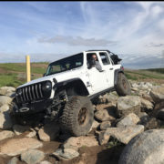
El Dorado National Forest - (closest to us, includes our trail). Seasonal closure is in effect until at least March 31st. Details on main routes can be found at the link below. FS updates occasionally. EDNF also has a twitter that is regularly updated with info on Mormon Immigrant Trail.
https://www.fs.usda.gov/detail.....7_019037
Tahoe National Forest - (north of EDNF, includes fordyce and signal peak). Seasonal closure in effect until at least March 31st. Details on main routes can be found at the link below. Highway 80 section is probably most relevant. This FS office is terrible at updating their site. When in doubt, use the info on the maps about closures.
https://www.fs.usda.gov/detail.....rdb5299395
Rubicon Trail - (the trails is a county road so it is subject to a totally different management structure). The trail is open most of the year but does close during work, events, and big storms. The link below is the county conditions report that is the best way to know if it is open. Though the trail doesnt close over winter, it is impassible for most rigs until about may due to snow. A winter crossing (when there is snow) requires big tires, lots of digging, lots of winching, ~250ft of winch line extensions, tons of extra fuel, etc. The pirate4x4 link is the best place for up to date trail info.
https://www.edcgov.us/Governme.....dates.aspx
http://www.pirate4x4.com/forum.....con-trail/
Tahoe Basin Management Unit - (all areas near tahoe, ellis peak, blackwood canyon, genoa peak ) Seasonal closure in effect. Re-opening date vary trail to trail. Most open on either May 15 or June 1. The link below lists the closure dates for campgrounds and halfway down the page trails and roads are listed. There is no good place to get info on conditions since this FS office just closes everything seasonally.
https://www.fs.usda.gov/wps/po.....RDB5291839
Stanislaus National Forest - (south of EDNF, slickrock trail and southern end of deer valley trail) Seasonal Closure in effect. Trails re-open on April 15. Below is a link to the conditions and access to various campgrounds and sites within the forest. This office is terrible about updating conditions but doesnt like to extend closures so if the map indicates somehting is open, it likely is.
12:55 pm
Club Member
March 5, 2015
 Online
Thanks Kris for all the updates that is definitely some good information to have
Dale Clement
4:32 pm
Club Member
February 26, 2014
Offline
Thank you Kris for all your hard work
10:29 pm

Club Member
January 19, 2011
Offline
Thanks Kris. Nice to have this information available to us.
Semper Fi
12:10 pm
Club Trailmaster
March 13, 2015
Offline
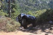
Trail closure is over! All roads are open! Well except those that are damaged by storms. Info below:
"
Use Caution!
- SMUD has reported some undercutting of the Ice House road between the Wentworth Springs road turnoff and Loon Lake.
Roads closed due to storm damage.
The following roads were damaged over the winter and are closed until repairs are made:
- 11 Pines Rd
- Ellis Rd
- Black Smith Flat Rd
- Salt Springs Rd
- Forebay Rd
- Slab Creek Rd
- Plum Creek Rd
- Granite Springs Rd
- Alder Creek Rd
- Bridal Veil picnic area
- Panther Creek Road
- Weber Mill Rd
- Pigeon Roost Rd
- Jaybird Springs Rd
Crews are working now to prevent additional imminent damage at sites not-yet failed. Engineers are reviewing the road damage and designing repairs. Some repair work is already being accomplished by FERC licensees to open access to their facilities. "
1:08 pm
Club Member
September 3, 2008
Offline
All trails are open??? That was faster than I thought.
Um...what?
3:41 pm
Club Trailmaster
March 13, 2015
Offline
Gregulator said
All trails are open??? That was faster than I thought.
Yep. Further proof that the closures are just about restricting access and not about addressing runoff issues. But hey, they are open so I'm not complaining.
9:18 pm
October 28, 2016
Offline

So the side trails of Mormon are open? Well most
W6JLU
2:57 pm
Club Trailmaster
March 13, 2015
Offline
Brian said
So the side trails of Mormon are open? Well most
Yep. And that is in spite of the predicted snow up there this weekend.
7:26 am
Club Member
August 17, 2014
Offline
Thanks Kris for the research & report. You know, opening some of these roads in the conditions they currently are, leads into more damage. Sound like to me that these entities are too lazy to do their own investigations to save the roads that need saving from more damage.
1 Guest(s)

