Don't Forget, meetings have moved to our new location @ Mark and Monica's Family Pizza, 4751 Manzanita Ave., Carmichael, CA 95608!


7:51 pm
Club Trailmaster
March 13, 2015
 Offline


(all links have been updated, if one isnt working please let me know) See last posts for latest info
Currently all local forests are in winter closure mode. Open trails, such as mormon immigrant, are labeled on the individual forest OHV use maps. Below is some detail on the individual forests and their planned opening dates. Note that a forest order may be used to extend a seasonal closure if there is still snow on the ground.
El Dorado National Forest - (closest to us, includes our trail). Seasonal closure is in effect until at least March 31st. Details on main routes can be found at the link below. FS updates occasionally. EDNF also has a twitter that is regularly updated with info on Mormon Immigrant Trail. Note that some of the storm damage from last winter still has not been repaired.
https://www.fs.usda.gov/detail.....7_019037
Tahoe National Forest - (north of EDNF, includes fordyce and signal peak). Seasonal closure in effect until at least March 31st. Details on main routes can be found at the link below. Highway 80 section is probably most relevant. This FS office is terrible at updating their site. When in doubt, use the info on the maps about closures.
https://www.fs.usda.gov/detail.....rdb5299395
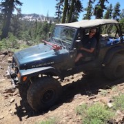
Rubicon Trail - (the trails is a county road so it is subject to a totally different management structure). The trail is open most of the year but does close during work, events, and big storms. The link below is the county conditions report that is the best way to know if it is open. Though the trail doesnt close over winter, it is impassible for most rigs until about may due to snow. A winter crossing (when there is snow) requires big tires, lots of digging, lots of winching, ~250ft of winch line extensions, tons of extra fuel, etc. The pirate4x4 link is the best place for up to date trail info.
https://www.edcgov.us/Governme.....dates.aspx
http://www.pirate4x4.com/forum.....con-trail/
Tahoe Basin Management Unit - (all areas near tahoe, ellis peak, blackwood canyon, genoa peak ) Seasonal closure in effect. Re-opening date vary trail to trail. Most open on either May 15 or June 1. The link below lists the closure dates for campgrounds and halfway down the page trails and roads are listed. There is no good place to get info on conditions since this FS office just closes everything seasonally.
https://www.fs.usda.gov/wps/po.....RDB5291839
Stanislaus National Forest - (south of EDNF, slickrock trail and southern end of deer valley trail) Seasonal Closure in effect. Trails re-open on April 15. Below is a link to the conditions and access to various campgrounds and sites within the forest. This office is terrible about updating conditions but doesnt like to extend closures so if the map indicates somehting is open, it likely is.
10:23 am
Club Member
July 14, 2016
Offline
Thanks like always for the great info
Mike G
9:15 am
Club Member
March 5, 2015
Offline
Great info Kris
Dale Clement
10:17 am
Club Trailmaster
March 13, 2015
Offline
There has been a lot of posting online lately on various sites of people looking for suggestions for open-in-winter areas and even posting of pics and planning trips on closed trails. To help prevent this I have been reviewing trails in the area and have some suggestions. The MVUMs are the rule so all we have open legally in out area is the Rubicon and MET. Tahoe, El Dorado, and Stanislaus have pretty complete winter closures. Plumas and Mendocino NFs are the opposite with few areas under seasonal closures.
If you want high elevation camping then I recommend the gold lake 4x4 camp outside of Graeagle. This camp is in a small finger of the forest and all trails to the South and west are in Tahoe NF.
Next would be Plumas NF which extends down to New Bullards Bar Reservoir. There are 2 seperate 4x4 camps and trails start a quick drive off HWY 20 between Marysville and Grass Valley. https://www.fs.usda.gov/recare.....8;actid=34
Next option would be Mendocino NF. Pretty much everything Indian valley reservoir up past stoneyford is open. Only downside to Mendocino is it is they charge $4.99 for the trail map.
And there is always Nevada which is more BLM than NF.
7:02 pm
Club Member
February 26, 2014
Offline
Thanks for the info Kris your the best
7:32 am
Club Member
August 17, 2014
Offline
Thanks Kris. This stuff is great. U certainly have a lot of good resources and knowledge.
8:13 am
Club Trailmaster
March 13, 2015
Offline
El Dorado NF has extended the winter trail closures until April 15th due to the amount of moisture up the hill. I have not seen other forests release the same info but they are likely to follow suit.
11:17 am
Club Trailmaster
March 13, 2015
Offline
2017/2018 winter closure has officially been lifted from El Dorado NF. They posted the following.
"Although the Seasonal Closure has been lifted roads may still be wet at this time of year and vulnerable to damage. It is your responsibility to make good decisions about traveling on a wet road as you may be liable for road damage."
As of today MET is still gated at the top and there is still snow in most areas. What this means is use your judgement. Dont go making mud holes or tearing stuff up. If it looks too wet or too covered in snow then turn around. There are also a number of roads still impacted by the storm damage from last year. Click here for more info: https://www.fs.usda.gov/detail.....ev7_019037
If you have any specific questions then give the forest service a call, turns out they are friendly.
Tahoe national forest should be open as well but they aren't as good about posting online so you have to call the ranger district office in the area you want.
Tahoe basin stuff will be closed till mid May to June depending on the trail per usual.
Stanislaus NF has re-opened as normal but has yet to survey all roads to know if any will be closed. Some roads are still closed due to last years storms but most trails should be legally open. I will post up if anything changes. Click link for more info: https://www.fs.usda.gov/detail.....EPRD576298
11:53 am
Club Member
August 17, 2014
Offline
Thanks for this important information Kris.
12:46 pm

Club Member
January 19, 2011
Offline
Thanks for the update Kris.
Do you know if the road to HellHole was ever fixed?
Semper Fi
6:13 pm
Club Trailmaster
March 13, 2015
Offline
Josh said
Thanks for the update Kris.Do you know if the road to HellHole was ever fixed?
Kevin remembered to ask about this when we met with Kyle. I dont remember the name of the road but many of the washed out roads have not been fixed. Was it 11 Pines Rd? If so it is still closed but they do have a contractor lined up for this year.
6:29 pm
Club Member
July 14, 2016
Offline
Josh said
Thanks for the update Kris.Do you know if the road to HellHole was ever fixed?
Jeff R, dustpan, Dale and I went to hellhole last year for a father's day run not sure the way we went Jeff R was our guide so you can ask him
Mike G
11:06 am

January 20, 2009
Offline
There's 4 main ways that I know of to get to Hell Hole.
1. From Georgetown, take Wentworth Springs to 11 Pines Rd (currently CLOSED) to Hell Hole.
2. From Foresthill, take Mosquito Ridge Rd to Rubicon Road to Ramsey Crossing Road to Hell Hole. (my favorite, and the fastest if you live on the 80 side. I've done this several times.)
3. From Foresthill, take Mosquito Ridge Rd to French Meadows Reservoir to Hell Hole. (I think this is how they went last year.)
4. From Foresthill, take Foresthill Rd to Robinson Flat Rd to French Meadows Reservoir to Hell Hole. (the long way!)
These are generalized directions. Check your maps accordingly. 🙂
Kevin
8:23 pm
Club Member
January 19, 2011
Offline
Thanks for the feedback Kevin, Kris, and Mike.
Semper Fi
11:27 am
Club Trailmaster
March 13, 2015
Offline
Deer Valley Update-
So long as the snow gauge at Blue Lake does not get more than 1" of snow in the next storm (friday night/saturday), Deer Valley is on track to open on Sunday July 1. (this should be considered a generally early opening considering how strict the environmental decision was.) The storm forecast per NOAA is "New snow accumulation of less than one inch possible" for friday night and "New snow accumulation of less than a half inch possible" for saturday but the low is only forecast at 31 so we should be ok.
1 Guest(s)

